Deforestation

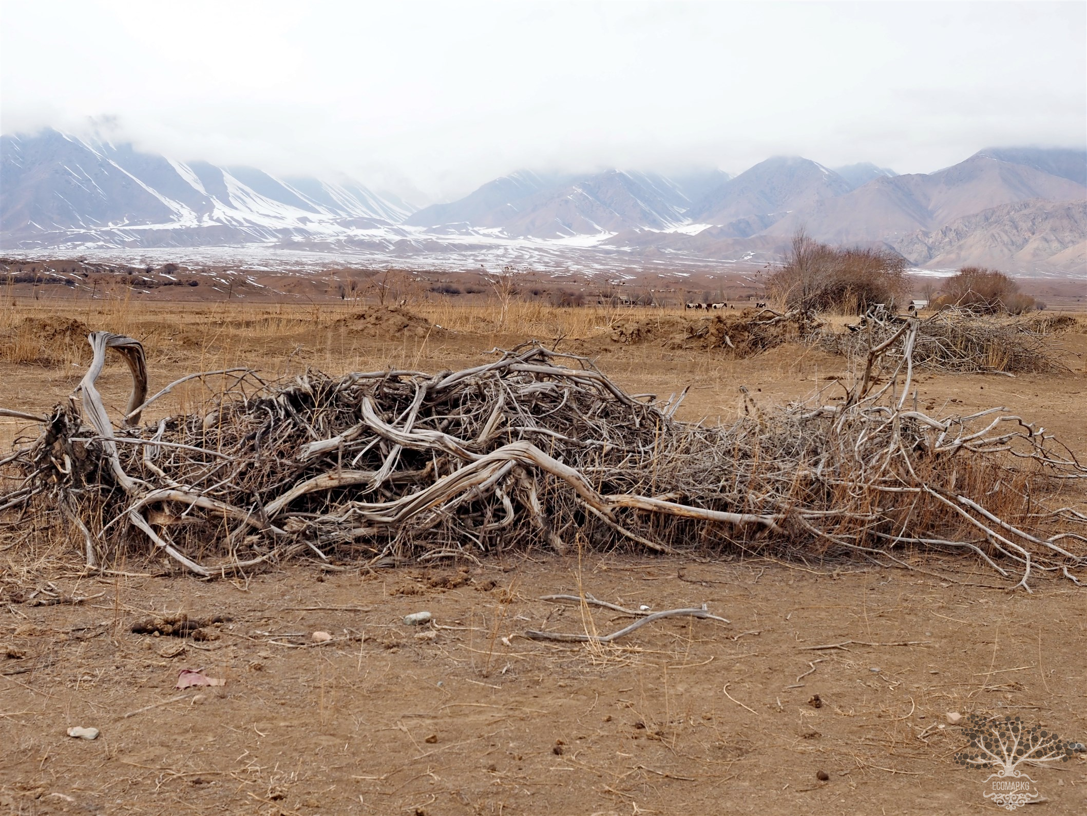
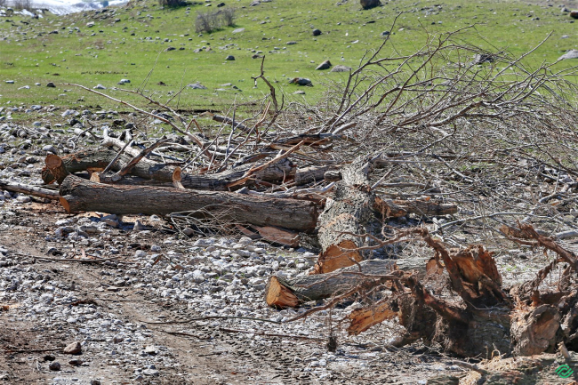
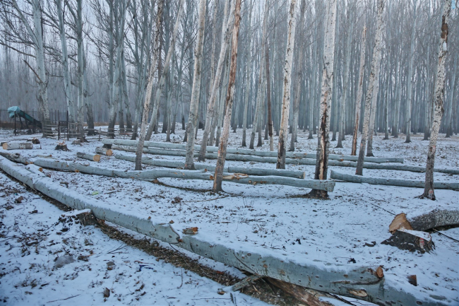
River Orto Kuugan. Destruction of the floodplain forest. Changes in the riverbed.

Coordinates: 41.989273, 74.574591 Floodplain forests are unique ecosystems located along riverbeds. In Kyrgyzstan, they play a crucial role: they protect against floods, stabilize the microclimate, serve as a refuge for rare and endangered species of plants and animals, and provide soil fertility and clean water. However, in recent years, these green lungs of the country have been under real threat – they are being barbarically cut down for the extraction of inert materials and the production

Deforestation

The park is being destroyed in the only cardiology sanatorium in Kyrgyzstan.

Coordinates: Latitude 42°41.8964 Longitude 74°32.2616 A unique park of the cardiological sanatorium of Kyrgyzstan is being destroyed. Under the guise of deadwood and emergency trees, healthy trees are being cut down, including those that have a special environmental protection status in the country (juniper). Activists from the villages of Tash-Dobo and Baytik are asking to save the only unique sanatorium in the country known for its healing properties. Without this recreational park, the

Deforestation

Tree Cutting in the Suu-Bashi Gorge

Suu-Bashy Gorge. Deforestation (26 trunks of poplar and tal). "Suu Bashy (The Beginning of Water) is a natural complex consisting of a huge old poplar, springs, and a small pond with a diameter of 10-12 meters. Suu Bashy is located at the foot of the mountains, not far from the village of Kara-Bulak in the Batken region. The waters of Suu-Bashy are crystal clear, emerging from the surface, purified by underground stones. The poplar is so large that five people holding hands cannot encircle

Deforestation

Illegal logging in the Djukuchak Gorge

42°10’1877″N 78°01’3708″E Over the past 70 years, poachers have reduced the area of Kyrgyzstan's forests by three times. Activists claim that the destruction of forest areas is particularly active in the Issyk-Kul region. Activists assert that almost every winter, illegal logging occurs in the Barskoon, Juku, and Jety-Oguz gorges. In each of these areas, facts of illegal logging are discovered every year. Witnesses of the logging capture on video bare stumps, recently cut trunks, and traces of

Deforestation

Tree Cutting in the Ecopark of Jalal-Abad City

40°57’3018″N 72°58’9412″E An abandoned plot of land that had turned into a garbage dump was decided to be transformed into an eco-park in 2007. In 2010, the park was handed over to the city administration of Jalal-Abad. However, in 2016, by court decision, it was returned to the organization that took the land for a 49-year lease. At one time, the park was planted with Tien Shan firs, white birches, and expensive saplings. In 2017, a large fire occurred on the park's territory, after which

Deforestation

Uncultivated placer gold deposit on the Kasan-Sai River. Company "Chatkal-17"

41°27’3397″N 71°12’0132″E Extraction and exploration of placer gold in riverbeds and floodplains is one of the most environmentally hazardous types of mining activities. During the development of deposits, environmental protection legislation is not adhered to - this concerns land reclamation, negative impacts on water resources (untreated wastewater is often discharged into rivers). Placer gold is found in the upper reaches of rivers, essentially at their sources. Negative impacts on the

Deforestation

Uncultivated Alluvial Gold Deposit on the Kasan-Sai River. Kara-Dobo

41°29’5456″N 71°03’18172″E Extraction and exploration of placer gold in riverbeds and floodplains is one of the most environmentally hazardous types of mining activities. When developing deposits, environmental legislation norms are not followed - this concerns land reclamation, negative impacts on water resources (untreated wastewater is often discharged into rivers). Placer gold is found in the upper reaches of rivers, essentially at their sources. Negative impacts on the sources translate

Deforestation

Chuya Forestry. Mass Clear-Cutting of Forest Plantations

75°15’12.720″E 42°50’46.920″N In the territory of the Chui Forestry Enterprise in the Chui District (Nizhnyaya Lugovaya Street, Tokmak, territory of the Chui Forestry Enterprise), there are mass clearings of forest plantations on leased plots, and economic activities are being conducted in areas where the forest has been destroyed. Industrial-scale excavations for fish farming are being carried out, and the groundwater flow is being altered, leading to further marshland formation, while the

Продолжая просматривать сайт ecomap.kg вы принимаете правила сайта.
ОК