Soil Pollution

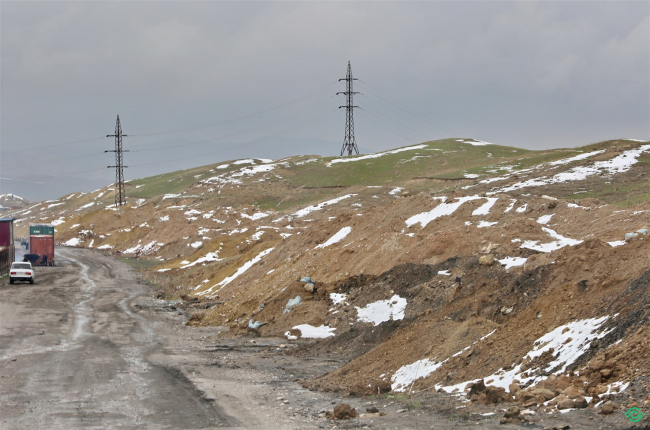
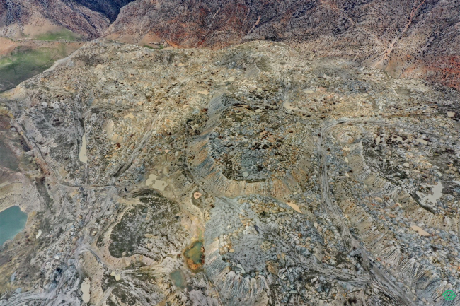
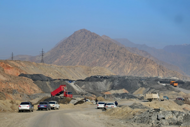
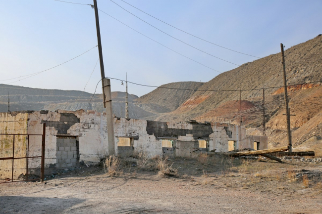
Coal Storage Facilities. Disruption of the Fertile Soil Layer.

39°55’7181″N 69°38’6175″E The coal industry is one of the most controversial in terms of profitability and one of the most dangerous in terms of its negative impact on the ecology and human health within Kyrgyzstan's fuel and energy complex. Despite the fact that many countries have recently begun to abandon coal in favor of alternative energy sources, thereby provoking a decrease in demand and devaluation of this type of fuel, local authorities still consider coal a promising sector of

Soil Pollution

Unreclaimed Coal Mines of the Sulyukta Deposit_2

30°57’1863″N 69°45’2760″E The coal industry is one of the most controversial in terms of profitability and one of the most dangerous regarding its negative impact on the ecology and human health within Kyrgyzstan's fuel and energy complex. Despite the fact that many countries have recently begun to abandon coal in favor of alternative energy sources, thus provoking a decrease in demand and devaluation of this type of fuel, local authorities still consider coal a promising sector of the industry

Soil Pollution

Old wastewater treatment facilities of the Leylek District Territorial Hospital

39°50’0992″N 69°32’7048″E After the installation of the new wastewater treatment system, the old treatment facilities were not dismantled, and no land reclamation work was carried out on their territory. This ultimately led to the marshy condition of the area and the infiltration of the accumulated mass into the groundwater. According to specialists, poorly treated wastewater and sewage from the city hospital deliver organic matter to the rural canal. The water is then used for irrigating

Soil Pollution

Tashkur Area. Unreclaimed section of the extraction of sarita, gypsum-limestone.

40°51’0312″N 73°07’3792″E The damage to soils from the barbaric extraction of construction materials, sand, and shell rock has reached alarming proportions in Kyrgyzstan. It is the raw materials for construction that are most often the target of illegal extraction, both by "black geologists" and licensed companies. To grasp the scale of illegal and semi-legal development of deposits of the same saw limestone, one does not need to look far. It is enough to open any image of Kyrgyzstan

Soil Pollution

Pollution of Arable Land

42°48’8267″N 75°24’5319″E Plastic pollution is represented in many forms, including the contamination of water bodies, water pollution with plastic particles, plastic nets, and so on. A large number of plastic products produced each year are intended for single use: disposable packaging items or products that are typically discarded within a year. Often, consumers of various types of plastic products use them once and then throw them away or replace them. The average decomposition time for

Soil Pollution

Aylampa-Sai Gorge. Industrial Waste Disposal Site of MSELZ

41°15’3504″N 72°25’5819″E Industrial waste dumps are always one of the adverse factors affecting the health of the local population. The MSELZ waste dump in Mailuu-Suu consists of mountains of broken glass and soil mixed with metal parts from defective light bulbs. The glass dump is a rather apocalyptic sight: a giant mound of wet glass towers among the stunted mountain shrubs. Just ten years ago, thousands of residents of Mailuu-Suu were extracting non-ferrous metals (nickel) from it. The

Soil Pollution

Tegene Coal Mine

41°24’1719″N 72°12’6224″E Quarries, dumps, dust, smoke, poor atmosphere, and intensive open-pit mining cause landslides. The landscape is worse than on the Moon, the air is literally saturated with coal dust, leaving a dark residue everywhere—these are the accompanying "delights" of coal mining activities in Kyrgyzstan. Currently, coal mining in the mining industry of Kyrgyzstan is associated with environmental degradation. Most large enterprises operate in open coal quarries.

Soil Pollution

Destruction of the Natural Monument Urchuk-Tash

41°19’3361″N 72°08’6698″E “Urchuk-Tash” (translated from Kyrgyz as “urchuk” — a spur of a mountain descending in a narrow strip; “tash” — stone) is nothing more than an anticlinal fold — a consequence of a deep tectonic fault in the Earth's crust. In the fault zone, over an area of 15-20 square kilometers, underground forces have gifted us with a natural chronicle of the Earth spanning 200 million years. Here, in the fault zone, one can see traces of ancient seas, remnants of volcanic activity,

Soil Pollution

Operating coal mine and unreclaimed dumps

41°23’9408″N 72°13’4417″E Quarries, dumps, dust, soot, poor atmosphere, and intensive open-pit mining cause landslides. The landscape is worse than on the Moon; the air is literally saturated with coal dust, leaving a dark residue everywhere—these are the accompanying "delights" of coal mining activities in Kyrgyzstan. Currently, coal extraction in the mining industry of Kyrgyzstan is associated with environmental degradation. The extraction of minerals from the depths of Tashkumyr is

Soil Pollution

Unreclaimed Coal Mine

41°23’9412″N 72°13’4413″E Quarries, dumps, dust, smoke, poor atmosphere, and intensive open-pit mining lead to landslides. The landscape is worse than on the Moon; the air is literally saturated with coal dust, leaving a dark residue everywhere—these are the accompanying "delights" of coal mining activities in Kyrgyzstan. Currently, coal mining in the mining sector of Kyrgyzstan is associated with environmental degradation. The extraction of minerals from the depths of Tashkumyr is

Продолжая просматривать сайт ecomap.kg вы принимаете правила сайта.
ОК