Radiation

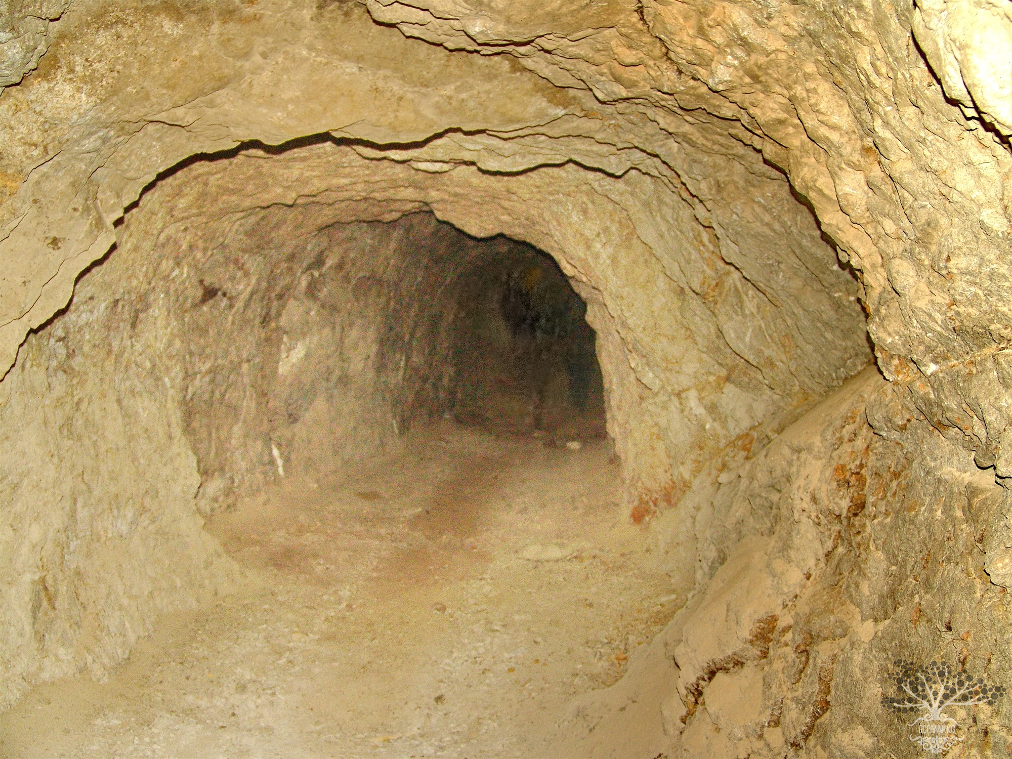
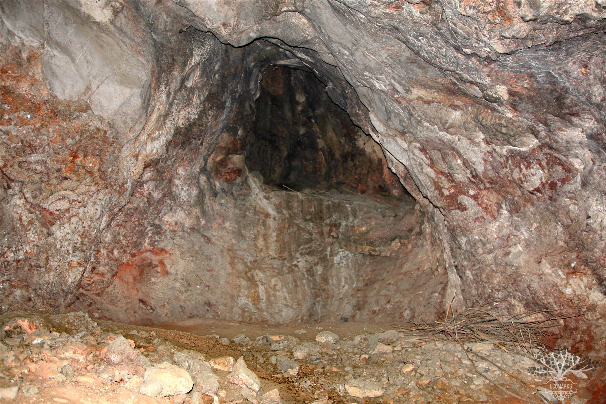
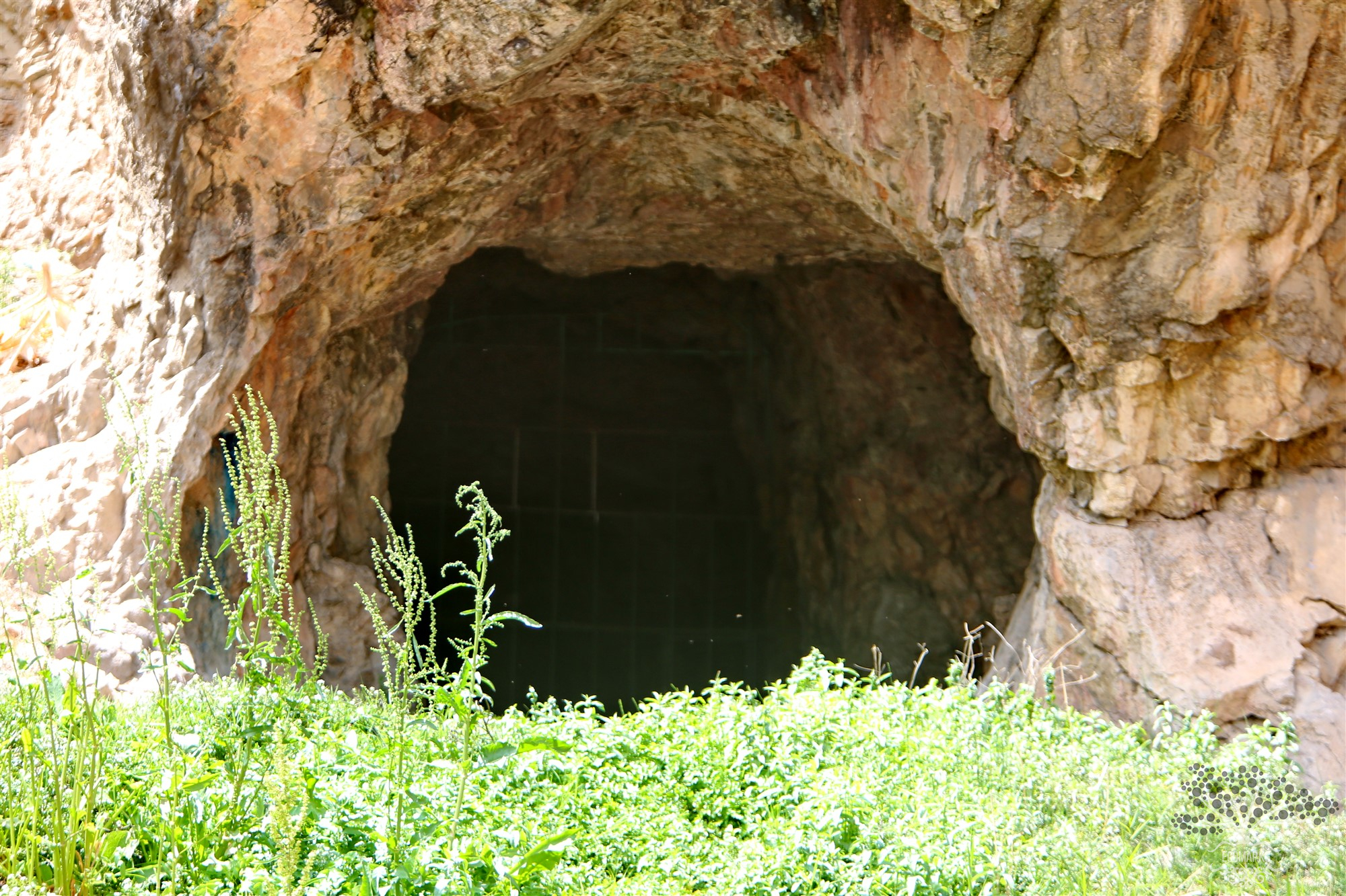
Radiological Situation in the Area of the Former Radium Mine "Tuya-Muyun". Fersman Cave

Coordinates: 40.357283, 72.585779 The Tuyamuyun massif is a latitudinally elongated block of Lower Carboniferous massive limestones up to 600 m wide. The limestones are almost vertically inclined, broken into blocks, marbleized, brecciated, and cut by calcite veins. They are trapped between the rocks of the Paleozoic strata (coal and clay shales, sandstones, siliceous shales, effusive rocks), separated from them by faults. The surface of the massif is a gently sloping plateau to the north with

Radiation

Radiological Situation in the Area of the Former Radium Mine "Tuya-Muyun". Large Barite Cave.

Coordinates: 40.353084, 72.597273 The Tuyamuyun massif is a latitudinally elongated block of Lower Carboniferous massive limestones, up to 600 m wide. The limestones are almost vertically inclined, broken into blocks, marbleized, brecciated, and cut by calcite veins. They are trapped between Paleozoic strata of interbedded rocks (carbonaceous and clayey shales, sandstones, siliceous shales, effusive rocks), separated from them by faults. The surface of the massif represents a gently sloping

Radiation

Radiological Situation in the Area of the Former Radium Mine "Tuya-Muyun". Unreclaimed Shaft.

Coordinates: 40.353665, 72.609550 The Tuyа-Muyun massif is a latitudinally elongated block of Lower Carboniferous massive limestones, up to 600 m wide. The limestones are almost vertically inclined, broken into blocks, marbleized, brecciated, and cut by calcite veins. They are squeezed between Paleozoic strata of interbedded rocks (coal and clay shales, sandstones, siliceous shales, effusive rocks), separated from them by faults. The surface of the massif is a gently sloping plateau to the

Radiation

Burial Site for Radioactive Waste of the Republican Specialized Combine (RSC)

43.065664, 74.422723 The state enterprise Republican Specialized Combine (RSC) has been operating since May 1965 and is intended for the collection, transportation, burial of radioactive waste, decontamination of special clothing and linen contaminated with isotopes, as well as for the delivery of radioactive materials to medical institutions in Bishkek. For this purpose, there is a radioactive waste burial site (RWBS), with a decontamination station for vehicles and containers, a garage for

Radiation

Tails and Tailings of the Kara-Baltin Mining and Processing Plant

Coordinates: Latitude 42°775173 Longitude 73°832779 The Kara-Balta Mining and Processing Plant (KGPP) is the largest enterprise for the processing of uranium-containing ore in Central Asia. It causes colossal harm to the environment, as the burial of radioactive and toxic waste poses the greatest ecological danger. Four tailings storage facilities in Kara-Balta were actively used from 1955 to 1993. Currently, one of them is periodically used for the storage of non-radioactive gold production

Radiation

Uranium Tailings Storage of Maili-Suu. 23 Tailings Storage Facilities

41°17’8047″N 72°28’8272″E In 1946, industrial development of the Mailuu-Suu deposit began. In the late 1940s, the atomic industry started to form in Kyrgyzstan, focused on fulfilling military programs. It was during this period that the development of mines with high uranium and rare earth material content began. From 1966 to 1973, 23 tailings dumps containing about 2 million cubic meters of radioactive waste were decommissioned on the territory of the former mines. Mailuu-Suu is unique in that

Radiation

Uranium Tailings Storage of Maili-Suu

41°17’8047″N 72°28’8272″E In 1946, industrial development of the Mailuu-Suu deposit began. In the late 1940s, the atomic industry started to form in Kyrgyzstan, focused on fulfilling military programs. It was during this period that the development of mines with high uranium and rare earth material content began. From 1966 to 1973, 23 tailings containing about 2 million cubic meters of radioactive waste were sealed on the territory of the former mines. Mailuu-Suu is unique in that there is

Radiation

Uranium Tailings Storage of Maili-Suu in the Ailampa-Sai Gorge (5 Deposits)

41°15’2191″N 72°25’4548″E In 1946, industrial development of the Mailuu-Suu deposit began. In the late 1940s, the atomic industry started to form in Kyrgyzstan, aimed at fulfilling military programs. It was during this period that the development of mines with high uranium and rare earth material content began. From 1966 to 1973, 23 tailings containing about 2 million cubic meters of radioactive waste were decommissioned in the area of the former mines. Mailuu-Suu is unique in that there are

Radiation

Uranium Tailings Storage of Maili-Suu in the Ailampa-Sai Gorge

41°15’2191″N 72°25’4548″E In 1946, industrial development of the Mailuu-Suu deposit began. In the late 1940s, the atomic industry started to form in Kyrgyzstan, focused on military programs. It was during this period that the development of mines with high uranium and rare earth material content began. From 1966 to 1973, 23 tailings containing about 2 million cubic meters of radioactive waste were decommissioned in the area of the former mines. Mailuu-Suu is unique in that there is little

Radiation

Uranium Dumps of Kyzyl-Zhar – 12

41°16’8325″N 71°596774’8734″E In the village of Kyzyl-Djar-12 in the city of Tash-Kumyr, uranium was mined during the Soviet era. This led to a high degree of land degradation around the village, an increase in desertification processes, and deforestation. The lack of positive practices for combating land degradation and proper pasture management resulted in an annual increase in the strength of dust winds and storms during the summer, with exposure dose rates ranging from 20 to 210 µR/h from

Продолжая просматривать сайт ecomap.kg вы принимаете правила сайта.
ОК