EcoMap.kg » Incidents » Page 63
Air Pollution

Residents of Kanta complain about emissions from the "Kant Cement Plant"

74°52’06.905″E 42°54’40.871″N According to them, smoke from the factory's chimneys spreads for several kilometers around and poisons residents not only of Kant but also of nearby villages - Dmitrievka and Ivanovka. In addition to the unpleasant smell, people are concerned about cement dust that settles on all surfaces. According to specialists, the main emissions into the atmospheric air are dust, nitrogen oxides (NOx), and sulfur dioxide (SO2). Volatile organic compounds, polychlorinated

Air Pollution

The municipal landfill is turning Bishkek into the most toxic city on Earth.

74°35’13.475″E 42°58’05.700″N Next to Bishkek is the largest municipal landfill, which has been burning for many years. Due to the spontaneous combustion of waste, dioxins are released into the air, and the garbage decomposes, emitting harmful gases and leachate consisting of a mixture of toxic substances, all of which seep into the groundwater. Sometimes there are raging fires, and sometimes it smolders quietly. However, residents of nearby villages assure that every evening a dense, acrid fog

Poaching (Animals)

Synthetic Fishing Nets. Poaching

Coordinates: 42°38’52″E 71°37’06″N Synthetic fishing nets used by poachers are strong and durable, and they practically do not decompose in water, leading to their accumulation in lakes and other water bodies. As a result, the lakes and other water bodies of the Kyrgyz Republic become littered with huge quantities of nets made from synthetic materials. In these nets, fish as well as waterfowl become entangled and die, turning water bodies and lakes into a true graveyard for the fish caught in

Landfill

Landfill for Solid Household Waste

71°32’11″E 42°45’45″N The solid waste landfill (SWL) located in the Uchkorgon rural district of Chon-Kapka does not meet the most basic safety standards. The sanitary condition of the city dump is dismal. The open landfill, not to mention the aesthetic aspect, is a source of numerous environmental threats. The dump pollutes the air with toxic substances and dust, and contributes to the proliferation of carriers of dangerous infections—rats, flies, mosquitoes, and birds. All existing landfills

River Urmaral. Destruction of the Floodplain Forest

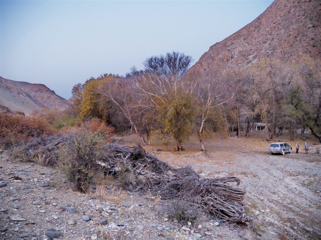
71°57’46″E 42°21’33″N After the suspension of gold mining at the mouth of the Urmaral River by the company "Polyus Gold KG," proper reclamation of the deposit was not carried out, which originally included the complete restoration of the quarry to its original state, including the restoration of the biological soil layer and the planting of trees. The company "Polyus Gold KG" received a license for geological exploration of the Urmaral deposit in the spring of 2017. Over the

Soil Pollution

Pass Otmyok. Pollution of High-Mountain Jailyks by Livestock Derivatives

73°8’30″E 42°17’9″N The Otmok Pass (elevation 3330) is located in the Talas region and stretches from Susamyr to Talas, connecting the region with the Suusamyr Valley and the Bishkek — Osh highway. The alpine highlands around the summit of the Otmok Pass are intensively used as summer pastures. Here, as well as on almost all major high-altitude pastures (dzhailoo), the skins of sheep, cows, and horses are discarded as unnecessary waste due to a lack of basic demand for them. The same situation

Water Pollution

Chychkan Gorge. Major Oil Product Spill

72°55’20″E 42°9’56″N The Bishkek-Osh road experiences dozens of ecological disasters every year involving overturned fuel tankers, resulting in hundreds of tons of highly toxic petroleum products: kerosene, fuel oil, gasoline spilled into high-altitude transboundary water intake rivers: Ablu-Naryn-Kara-Baltinka, Chychkan, and cubic meters of contaminated soil with complete destruction of flora and fauna in the tens of meters around.

Soil Pollution

Chychkan Gorge. Major Oil Product Spill After the Accident

72°55’20″E 42°9’56″N The Bishkek-Osh road experiences dozens of ecological disasters every year involving overturned fuel tankers, resulting in hundreds of tons of highly toxic petroleum products: kerosene, fuel oil, gasoline spilled into high-altitude transboundary water intake rivers: Ablu-Naryn-Kara-Baltinka, Chychkan, and cubic meters of contaminated soil with complete destruction of flora and fauna in the tens of meters around.

Water Pollution

Alabel Pass. Oil Product Spill

73°7’13″E 42°13’7″N The Bishkek-Osh road, every year dozens of ecological disasters involving fuel tankers overturning, every year, hundreds of tons of highly toxic petroleum products: kerosene, fuel oil, gasoline spilled into high-altitude transboundary water intake rivers: Ablu-Naryn-Kara-Baltinka, Chychkan, cubic meters of contaminated soil with complete destruction of flora and fauna in the tens of meters around.

Radiation

Uranium Disposal Site "Tuyuk-Suu" Near the Settlement of Min-Kush

74°28’2″E 41°39’31″N In the village of Min-Kush in the Naryn region, there are four tailings storage facilities and four ore and waste dumps. Those located near rivers are the most dangerous. All tailings storage facilities and waste dumps, except for the tailings storage facility in the village of Kadji-Sai, are situated in the basins of the Naryn and Maili-Sai rivers. For example, the burial site "Tuyuk-Suu" is located by the river of the same name near the village of Min-Kush. A

Продолжая просматривать сайт ecomap.kg вы принимаете правила сайта.
ОК
[/not-static]

Embed the map on your site

Just copy this code and paste it on your website. The map will update automatically.