Water Pollution

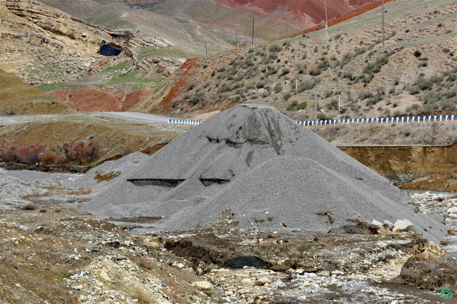
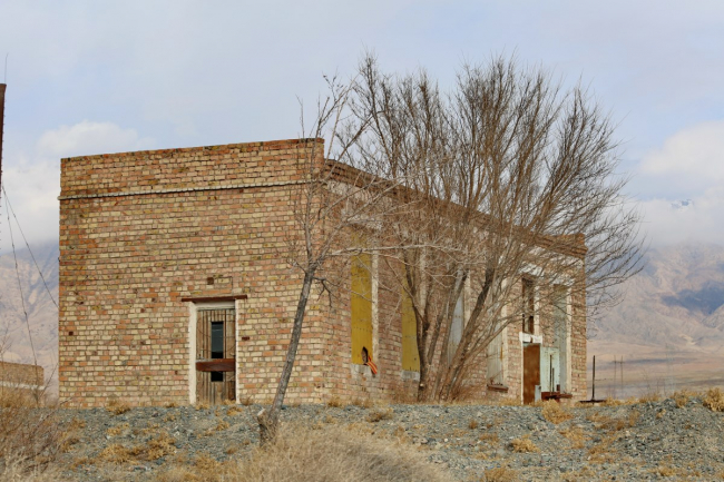
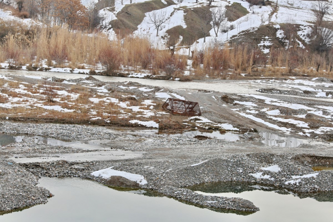
Kozu-Baglan River. Eski-Oochu (Kairagach). Extraction of inert materials. Violation of the water protection zone.

40°06’0682″N 69°41’3192″E In the floodplain of the Kuzu-Baglan River in the Batken region, illegal mining is taking place, as local residents use sand and gravel material for their household constructions or private homes. Unfortunately, there is no perfect methodology to accurately calculate the damage caused to the environment by illegal mining. However, this does not mean that the harm is insignificant, as the extraction of gravel-sand mixtures from the river disrupts the riverbed, creates

Water Pollution

Rivers Kozy-Baglan and Sary-Kyungey. Extraction of Inert Materials. Violation of the Water Protection Zone.

39°53’8371″N 69°54’2105″E In the floodplain of rivers, at the confluence of the Kozu-Baglan and Sary-Kyungey rivers in the Batken region, illegal mining is taking place, with local residents using sand and gravel materials for their household constructions or private homes. Unfortunately, there is no perfect methodology to accurately calculate the damage caused to the environment by illegal mining. However, this does not mean that the harm is insignificant, as the extraction of gravel-sand

Water Pollution

Change of River Course. Unlicensed Extraction of Inert Materials on the Abshir-Sai (Arashan) River

40°17’9989″N 72°20’6560″E Illegal mining is taking place on the Abshir-Sai River near the village of Arashan in the region, where local residents use sand and gravel material for their construction or private houses. Unfortunately, there is no perfect methodology that allows for an accurate calculation of the damage caused to the environment by illegal mining. However, this does not mean that the harm is insignificant, as the extraction of gravel-sand mixtures from the river disrupts the

Water Pollution

Pollution of the Baysoorun River Bed, Village of Ananyevo

42°43’7935″N 77°40’7113″E Currently, the ecological situation at Issyk-Kul is unfavorable, which has already led to a decrease in the recreational value of the lake complex, and if the existing negative trends continue, it may result in irreversible ecological and economic losses. The spontaneous dump along the Baysoorun River is the handiwork of local residents who uncontrollably dump garbage in the coastal area. There is a variety of waste here: construction debris, old furniture, plastic,

Water Pollution

Village Zhylyu-Bulak. Waste Disposal (Whey). Dairy Spring Cheese Production Plant

42°44’9993″N 78°37’6510″E One of the main sources of environmental pollution is industrial production, which involves significant amounts of natural resources. The dairy industry is no exception and is also one of the sources of environmental pollution, with dairy waste posing a serious threat to the environment. Waste from the "Sut Bulak" cheese factory ends up in the Tüp River. "Kisel rivers - milk shores" exist not only in fairy tales but also when a well-established

Water Pollution

Village of Zhylyu-Bulak. Pollution of the tributaries of the Tyup River (Dairy Spring cheese production plant)

42°45’5004″N 78°39’9741″E The "Sut Bulak" cheese factory discharges domestic and technical wastewater untreated into the Tyup River and Lake Issyk-Kul. One of the main sources of environmental pollution is industrial production, which involves significant volumes of natural resources. The dairy industry is no exception and is also one of the sources of environmental pollution, with dairy waste posing a serious threat to the environment. Impurities contained in the wastewater from milk

Water Pollution

The wastewater treatment facilities in Balıkçı are in emergency condition.

For the project Ecomap.kg 42°27’3712″N 76°06’9581″E The situation with municipal wastewater treatment facilities in the cities of Balykchy and Cholpon-Ata is particularly acute. They only conduct mechanical treatment, which is fraught with consequences. The biological component at the wastewater treatment plant in Balykchy is not operational, and its launch requires urgent commissioning work. Currently, 3,325 households and 106 commercial/industrial/institutional/tourist organizations are

Water Pollution

Unlicensed Gravel Mining. Alteration of the Maiyloo-Suu Riverbed. Floodplain Forest Cutting-1

41°04’7861″N 72°21’7952″E In Jalal-Abad, along the Maiylyu-Suu River, mostly unlicensed extraction is taking place, where local residents use sand and gravel materials for their outbuildings or private homes. Unfortunately, there is no perfect methodology to accurately calculate the damage caused to the environment by unlicensed extraction. However, this does not mean that the damage is insignificant, as the extraction of gravel-sand mixtures from the river disrupts the riverbed, creates pits,

Water Pollution

Unlicensed Gravel Extraction. Alteration of the Maiyloo-Suu Riverbed. Cutting of Floodplain Forest.

41°06’7761″N 72°21’7951″E In Jalal-Abad, along the Maiyluu-Suu River, there is predominantly unlicensed extraction, where local residents use sand and gravel material for their construction or private houses. Unfortunately, there is no perfected methodology to accurately calculate the damage caused to the environment by unlicensed extraction. However, this does not mean that the damage is insignificant, as the extraction of gravel and sand mixtures from the river disrupts the riverbed, creates

Продолжая просматривать сайт ecomap.kg вы принимаете правила сайта.
ОК